 |
 |
 |
 |
 |
 |
 |
 |
|
|
|
|
|
|
|
|
|
Ferraris, C. J., Jr. 2007. Checklist of catfishes, recent and fossil (Osteichthys: Siluriformes), and catalogue of siluriform primary types. Zootaxa 1418:1-628. (download pdf) |
|
subject |
click to download document or view webpage |
|
|
|
Copeia format (through 2008) |
|
General format |
Journals
(with pdfs available on-line)
|
1921–present |
|
|
1881–present |
|
|
2005–present |
|
|
2005–present |
|
|
2003–present |
|
|
1969–present |
Books
(available on-line)
|
Linnaeus, C. 1758. Systema naturae per regna tria naturae, secundum classes, ordines, genera, species, cum characteribus, differentiis, synonymis, locis. Tomus I. Editio decima, reformata. Laurentii Salvii, Holmiae, i-ii + 1-828 p. |
|
Linnaeus, C. 1766. Systema naturae per regna tria naturae, secundum classes, ordines, genera, species, cum characteribus, differentiis, synonymis, locis, 12th ed., Vol. 1 (pt 1), Laurentii Salvii, Holmiae, 1-532 p. |
Books
Organized by Roberto E. Reis, Sven O. Kullander & Carl J. Ferraris, Jr. (html order form)
Link to webpage with Addenda and Corrigenda
Informal list of discrepancies/corrections compiled by W.Eschmeyer & M.Hoang (fall 2004)
International Code of Zoological Nomenclature (4th Edition)
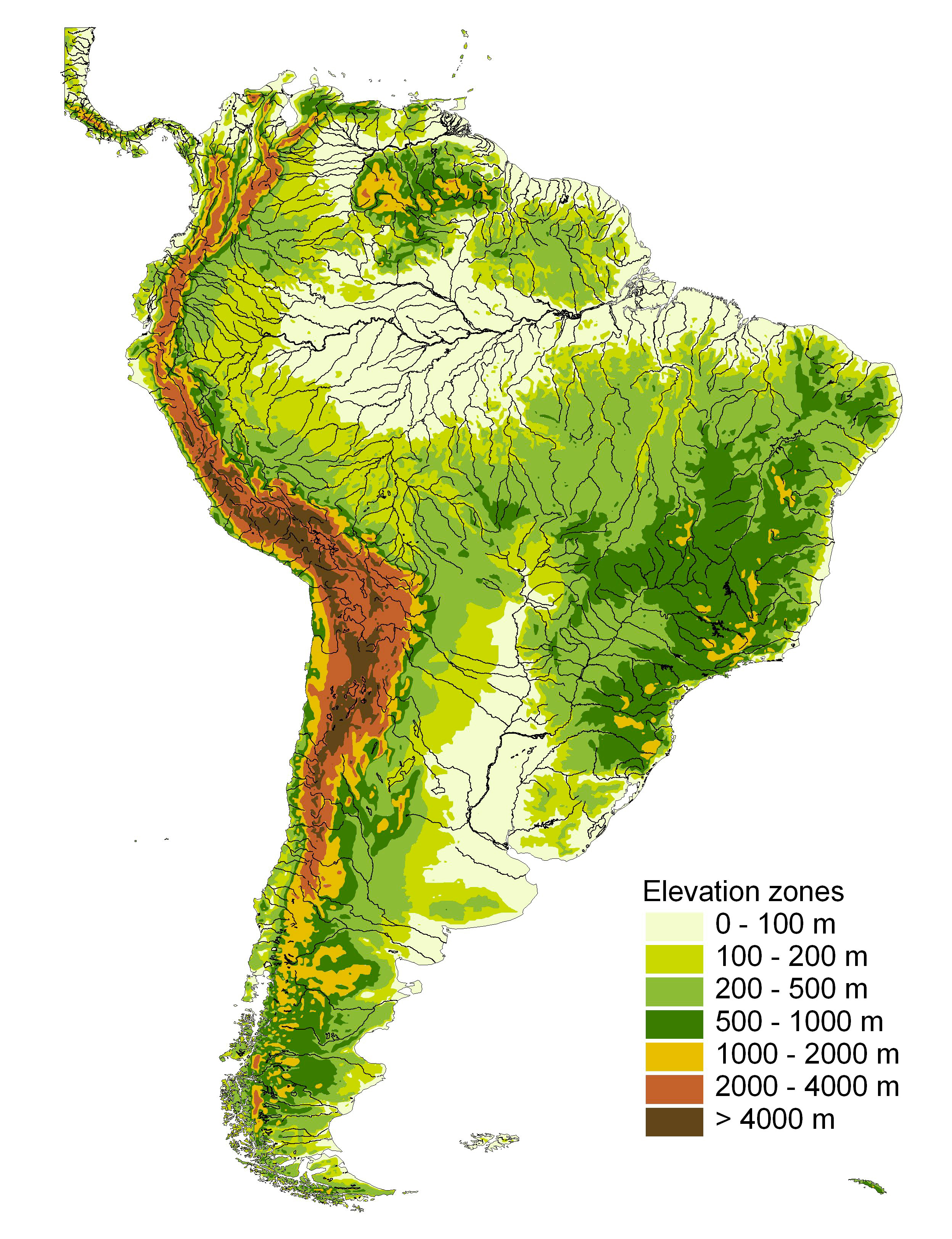
Maps
The following maps of South America were kindly prepared for ACSI by the World Wildlife Fund
(thanks to Robin Abell and GIS specialist Bernhard Lehner).
They are available for not-for-profit use (e.g., journal articles, other pubs, talks, etc.)
by ACSI participants with the following credit lines in the:
|
Figure Caption
|
Fig. xxx. _____. Base map of drainages and elevations provided by provided by Conservation Science Program, World Wildlife Fund US. |
|
Acknowledgement Section
|
B. Lehner, at the Conservation Science Program, World Wildlife Fund US, generously provided the base map used in Fig. xxx. |
 |
 |
|
|
|
|
to download, click on image to view full then drag to your desktop |